How many times have you watched eyes glaze over at a complex spreadsheet or robust report, or had someone misinterpret your findings?
The value of data is predicated on the insights it provides – information only becomes meaningful when it’s understood. And the overwhelming volume of data at our fingertips makes it easy to miss significant discoveries, especially if we don’t know what we’re looking for.
For this reason, Geographic Information Systems (GIS) have become pivotal in commercial real estate’s quest to uncover new and better ways to interpret and share data and analyses. GIS not only records information on a map but also integrates business and geographic data, such as land use, zoning, demographics, market trends, and property values, to help us understand and predict human behaviors.
Through GIS, users can swiftly filter data sets to narrow down opportunities related to site selection, market analysis, and property valuation, making well-informed real estate decisions faster. GIS maps are engaging and persuasive because they connect massive amounts of data from multiple sources into visual representations that uncover patterns and relationships that may go unnoticed in written reports or spreadsheets.
Mapping Opportunities
GIS mapping takes out the guesswork and simplifies complex concepts. Presenting data visually enables real estate professionals to identify correlations, outliers, and trends and prove theories more easily.
One of Transwestern’s national portfolio clients wanted to know how to optimize its real estate to increase revenue. The client’s raw data was transformed into actionable intelligence by applying GIS tools to graphically show the talent and business revenue surrounding an existing office location. The analytics revealed a faster-growing region where most of the company’s clients, competitors and employees were situated. With this information, the client confidently made a data-driven decision to move to a location that better supported its people and business objectives.
By linking demographic trends in labor and population with accessibility information (like drive times, transportation and parking) and cost factors (such as taxes and market rent), leasing agents can quickly recognize opportunities and barriers in tenant prospecting. Synthesizing this data with behavioral analysis and psychographics empowers them to customize leasing strategies for owner clients through more precise market segmentation.
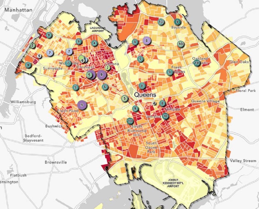
Transwestern’s New York team integrated public and charter school performance with child population and household income to identify an optimal site for a new charter school.
Asset services uses GIS to manage and maintain a database of property assets to track locations and conditions, prioritize maintenance and repairs, and monitor performance. It can also identify potential building and occupant risks like security threats, natural disasters, and environmental hazards.
In development and capital markets, GIS compares ownership and sale prices. A void analysis can determine a trade area’s supply and demand by showing gaps in the market for specific businesses and services. The ability to model potential future outcomes helps brokers make strategic decisions to drive long-term success and competitive advantage – GIS accelerates the time-consuming task of evaluating and integrating historical data for these predictive analytics.
Transwestern uses an ArcGIS StoryMap, an interactive combination of maps, imagery and text, to track all primary and secondary U.S. industrial real estate markets. Through a series of growth and absorption maps, the dashboard highlights core and growth markets luring global investors and developers and high-demand areas sought by big-box distribution users, logistics firms and manufacturing companies.

All Data is Not Created Equal
An analysis is worthless without the correct data, which makes the broad accessibility of information both a blessing and a curse. Because the GIS field is heavily rooted in research, GIS analysts ensure data integrity and quality by applying research best practices with expertise in sourcing accurate and relevant information from trusted sources.
The applications for GIS in commercial real estate are virtually endless. Rendering layers of spatial analysis on a single map helps an audience more easily connect the dots to comprehend the implications of different options, compare scenarios, and evaluate potential outcomes. With technology advancing at breakneck speed, GIS expertise is a must-have for leveling up performance and providing higher value to clients and business partners.
Paris Allen serves as National GIS Manager for Transwestern. She creates innovating mapping materials for clients to guide real estate strategies and support decision making.
SEE ALSO:
- Healthcare Systems Build Loyalty Through Real Estate
- Leveraging Economic Incentives in Site Selection
- Forecasting the Future of Warehouse Demand
- Pandemic Swings the Port Pendulum
RELATED TOPICS:
commercial real estate
economic incentives
nonprofit advisory
market reports